
When buyers scroll through listings online, they make split-second decisions about which properties deserve a closer look. In a market where first impressions are everything, drone photography has become one of the most powerful tools a real estate agent can use to capture attention, showcase a property's full potential, and ultimately close the deal faster. If you are selling a home in Central Florida, understanding the impact of drone photography on real estate marketing is not optional anymore — it is essential.
The Rise of Drone Photography in Real Estate
A decade ago, aerial photography for real estate meant hiring a helicopter or a manned aircraft — something only luxury listings could justify. The cost could run anywhere from $1,500 to $5,000 per shoot, putting it out of reach for the vast majority of sellers and agents.
Everything changed when the FAA established Part 107 regulations in 2016, creating a clear legal framework for commercial drone operations. Since then, drone technology has become smaller, more affordable, and dramatically more capable. Modern drones equipped with 4K cameras, GPS stabilization, and intelligent flight modes can capture stunning aerial imagery that rivals what only Hollywood production crews could achieve a generation ago.
The National Association of Realtors (NAR) has tracked this shift closely. Their research shows that aerial photography and video have moved from a luxury add-on to a standard expectation among both sellers and buyers. Agents who fail to offer drone photography risk looking outdated in a market that increasingly rewards visual storytelling and comprehensive property presentation.
Statistics That Matter: The Data Behind Drone Photography in Real Estate
The numbers make a compelling case for why drone photography belongs in every serious listing strategy:
- 68% more views: According to MLS data analyzed by the Wall Street Journal, listings that include aerial photography receive up to 68% more online views compared to listings with standard ground-level photos only.
- Faster sales: Properties marketed with drone photography sell up to 32% faster than those without, according to research from DroneBase and multiple MLS studies conducted across major U.S. markets.
- Higher engagement: Redfin's internal data has shown that listings with aerial images generate significantly more saves, shares, and click-throughs on their platform — the three key engagement metrics that signal genuine buyer interest.
- Buyer expectations are rising: A 2024 NAR survey found that 73% of homeowners said they would be more likely to list with an agent who uses drone photography. Buyers, especially those relocating from out of state, increasingly expect aerial views as standard.
- Price premiums: A study published in the Journal of Real Estate Research found that properties marketed with professional aerial photography sold for an average of 2-5% more than comparable properties without it, controlling for other listing variables.
These are not marginal improvements. For a $400,000 home in Central Florida, a 3% price premium translates to $12,000 in additional value — far exceeding the cost of a professional drone shoot.
What Drone Photos Reveal That Ground Shots Miss
Ground-level photography, no matter how skilled the photographer, has an inherent limitation: it can only show what a person standing at eye level can see. Drone photography eliminates that constraint entirely, revealing critical details about a property that buyers cannot appreciate from the sidewalk.
Property Boundaries and Lot Size
One of the most common frustrations buyers have is understanding exactly how much land they are getting. Ground photos make it nearly impossible to convey lot size, shape, or where the property lines actually fall. A drone shot taken from 100 to 200 feet up shows the full footprint of the property in context — the setbacks from the road, the depth of the backyard, the relationship between the home and the lot edges. For buyers evaluating a property for expansion potential, ADU construction, or simply understanding what they own, this perspective is invaluable.
Neighborhood Context
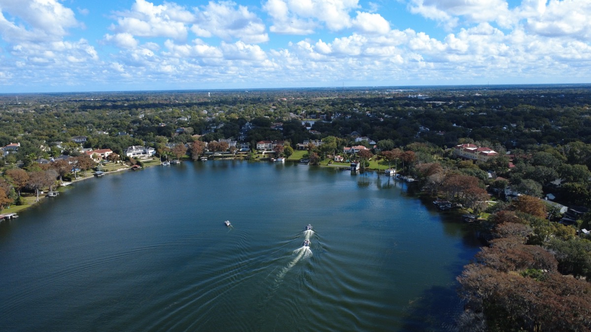
Buyers do not just purchase a house — they purchase a location. Aerial photography shows proximity to parks, schools, shopping, water features, and major roads in a way that a map pin simply cannot. A drone shot that captures a home's two-minute walk to a community park, its position on a quiet cul-de-sac, or its unobstructed view of a lake tells a story that ground-level photos and written descriptions struggle to convey.
Roof and Exterior Condition Overview
While a drone inspection does not replace a formal home inspection, aerial photos give buyers a preliminary look at the roof condition, gutter lines, exterior paint, and overall maintenance of a property. For sellers with a newer roof or recently completed exterior upgrades, this is an opportunity to show off those investments from the very first listing photo.
Surrounding Landscape and Views
Central Florida is defined by its lakes, mature tree canopy, and lush subtropical landscaping. Ground photos often fail to capture the canopy of live oaks shading a property, the proximity of a home to lakefront access, or the way a property sits within its natural surroundings. Drone photography reveals these features with striking clarity, turning environmental context into a genuine selling point.
Pool, Backyard, and Outdoor Living Spaces
Florida buyers care deeply about outdoor living. A pool, lanai, outdoor kitchen, or spacious backyard can significantly influence a purchasing decision. But photographing these features from ground level rarely does them justice — angles are awkward, fences block sightlines, and scale is difficult to convey. A drone positioned 30 to 50 feet overhead provides the perfect vantage point, showcasing the entire outdoor living area as a cohesive space rather than a series of disconnected close-ups.
Central Florida Properties That Benefit Most
While drone photography adds value to virtually any listing, certain property types in Central Florida see an outsized return on investment from aerial imagery.
Lakefront and Waterfront Properties
Central Florida has more named lakes than almost any other region in the country. In markets like Winter Park, Orlando, and Lakeland, lakefront properties command significant premiums. Drone photography is the only way to truly showcase a home's relationship to the water — the length of the shoreline, the size and shape of the lake, dock access, and the views that residents will enjoy daily. For lakefront sellers, skipping aerial photography is leaving money on the table.
Large Lots and Acreage
Properties with one acre or more present a unique marketing challenge from the ground. How do you convey 5 acres of usable land through standard photography? You cannot. Drone photography solves this problem entirely, showing the full scope of the land, clearing boundaries, existing structures, fencing, and terrain features like elevation changes or natural drainage.
Gated Communities and Amenities
Communities like Celebration and Lake Nona sell a lifestyle as much as a property. Aerial footage can capture the community pool, tennis courts, walking trails, and manicured common areas — showing buyers the complete package they are investing in, not just the four walls of the home.
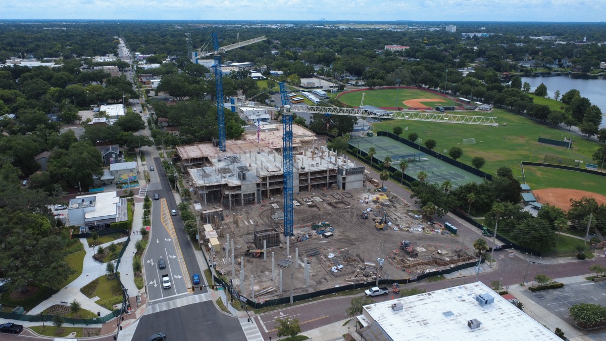
New Construction Developments
For new construction, drone photography documents progress, showcases the surrounding development, and gives buyers confidence in what the finished community will look like. Developers and builders increasingly demand aerial content for their marketing materials, and buyers expect to see it when evaluating whether to commit to a pre-construction purchase.
Commercial Properties
Commercial real estate buyers need to understand access points, parking capacity, signage visibility from major roads, and proximity to traffic flow. Aerial photography delivers all of this in a single compelling image, making it an essential tool for commercial listings in areas like Kissimmee, Sanford, and the greater Orlando corridor.
Aerial Video Tours: The Immersive Experience Remote Buyers Demand
Static aerial photos are powerful, but aerial video takes property marketing to another level entirely. A well-executed drone flyover creates a cinematic experience that puts the viewer in the pilot's seat, gliding over the property and its surroundings in a way that static images simply cannot replicate.
This matters enormously in Central Florida's real estate market, where a significant percentage of buyers are relocating from out of state. According to the Florida Realtors association, roughly 30% of all Florida home purchases involve buyers moving from other states — many of whom make initial purchasing decisions based entirely on online listings before ever visiting in person. For these remote buyers, an aerial video tour is the closest thing to physically walking the property and driving through the neighborhood.
Effective aerial video tours typically follow a structured sequence: starting with a wide establishing shot that shows the property's position within the neighborhood, then gradually descending and orbiting the home to showcase architecture and outdoor spaces, and finally pulling back for a dramatic reveal of surrounding amenities, waterfront access, or scenic views. When paired with ground-level interior video, this creates a complete virtual experience that can move buyers from casual interest to scheduled showing.
What to Expect From a Professional Drone Shoot
If you have never worked with a drone photographer before, understanding the process and legal requirements helps set expectations.
FAA Regulations and Part 107 Licensing
All commercial drone operations in the United States require the pilot to hold an FAA Part 107 Remote Pilot Certificate. This is not optional — it is federal law. The certification requires passing a comprehensive aeronautical knowledge test covering airspace classification, weather patterns, regulations, and emergency procedures. Always verify that your drone photographer holds a valid Part 107 certificate. Unlicensed operators put you at legal risk and may not carry the insurance required for commercial work.
The Shoot Process
A typical real estate drone shoot takes 30 to 60 minutes on-site, though preparation begins well before arrival. The pilot will check airspace restrictions (many parts of Orlando fall within controlled airspace near Orlando International Airport and Orlando Executive Airport), review weather forecasts, and plan specific flight paths to capture the most compelling angles for your property. On shoot day, expect the pilot to perform pre-flight safety checks, launch from a safe location on the property, and capture a variety of shots at different altitudes and angles. Most professional operators deliver edited photos and video within 24 to 48 hours.
Weather Considerations
Central Florida's weather presents unique challenges for drone photography. Afternoon thunderstorms are common from May through October, and wind speeds above 20 mph can affect image stability and flight safety. The best conditions for aerial real estate photography are typically early morning or late afternoon — the golden hours — when light is warm and directional, shadows add depth to architectural features, and Florida's notorious afternoon storms have not yet developed. Experienced pilots schedule accordingly and build weather contingency into their timelines.
Cost vs. ROI: The Investment Case for Aerial Photography
Professional drone photography for a single real estate listing typically costs between $150 and $500, depending on the scope of work — whether you need just photos, photos plus video, or a full aerial and interior media package. Compare that investment to the potential return:
- Faster time on market: Every week a property sits unsold costs the seller in carrying costs — mortgage payments, insurance, utilities, HOA fees, and opportunity cost. If drone photography helps a $400,000 home sell even two weeks faster, that is roughly $2,000 to $3,000 in saved carrying costs alone.
- Higher sale price: The 2-5% price premium associated with professional aerial marketing on a $400,000 home translates to $8,000 to $20,000 in additional value.
- More showing requests: Higher online engagement leads to more showings, which creates competition among buyers and strengthens the seller's negotiating position.
- Agent differentiation: In a competitive market, the listing presentation you offer to potential sellers can make or break whether you win the listing. Drone photography signals professionalism and a commitment to maximum exposure.
When you weigh a $200 to $500 investment against thousands of dollars in potential upside, the math is clear. Drone photography is not an expense — it is one of the highest-ROI marketing investments available in real estate today.
How Austin Integrates Drone Photography Into His Listings
This is where I have a unique advantage as your Central Florida real estate agent. I do not outsource drone photography to a third party and hope for the best. I am also the owner and operator of Central Florida Drone Services, a dedicated aerial photography and videography company serving the greater Orlando area.
I hold a current FAA Part 107 Remote Pilot Certificate, carry commercial drone insurance, and operate professional-grade equipment capable of capturing 4K video and high-resolution still photography. When you list with me, drone photography is not an add-on you pay extra for — it is built into my listing strategy from day one.
Here is what that looks like in practice:
- Pre-listing consultation: Before we even discuss pricing, I visit the property to identify its strongest aerial selling points — waterfront exposure, lot size, proximity to amenities, architectural features, or neighborhood context that buyers will care about.
- Strategic shoot planning: I plan the drone flight specifically around your property's unique features, choosing the right time of day for optimal lighting and the right altitudes and angles to tell your property's story.
- Professional editing: Every photo and video is professionally color-corrected and edited to ensure consistent, polished results that represent the property accurately and attractively.
- Multi-platform distribution: Aerial content is integrated across your MLS listing, Zillow, Realtor.com, social media, and my own marketing channels for maximum exposure.
This integrated approach means there is no coordination lag between your agent and a separate photographer, no miscommunication about what angles to capture, and no additional cost to you. The result is a listing that stands out from the first click.
You can see examples of my aerial photography work on the Drone Photography service page, or visit CentralFloridaDroneServices.com for my full portfolio.
Ready to Sell Your Central Florida Home With Aerial Photography?
If you are thinking about selling your home in Orlando, Winter Park, Kissimmee, Lake Nona, Sanford, Clermont, Celebration, Lakeland, or anywhere in the Central Florida area, drone photography should be a non-negotiable part of your marketing plan. The data is clear: aerial imagery attracts more buyers, creates stronger first impressions, and contributes to faster sales at higher prices.
As both a licensed Realtor with nearly a decade of Florida real estate experience and a certified commercial drone pilot, I bring a combination of skills that very few agents can match. Your listing deserves every advantage — and aerial photography is one of the most impactful advantages available.
Let's talk about how drone photography can help your property stand out. Call me at (863) 529-3611 or send me a message to schedule a no-obligation consultation.